What is a georeference?
When we create a map, we need to define a Georeference, i.e. geographic coordinates (latitude and longitude) that indicate the exact location of a point on the map. In BIMachine, in order to generate maps accurately, it is necessary to set up a specific structure that defines the Georeference as a Dimension Type.
How to create a georeferenced query
The query can be created in three ways:
- By Address
- By ZIP code
- By Latitude and Longitude
Query by Address
To ensure the best accuracy on the map, the ideal is to use the most complete address pattern possible, containing:
- Country (full name, no abbreviations)
- State (full name, no abbreviations)
- City
- Neighborhood
- Street
- Street number
- ZIP code (optional, but recommended)
Expected format: “Brazil”, “Rio Grande do Sul”, “Porto Alegre”, “Downtown”, “Street Example”, “123”, “90000-000”
This format is usually the most optimized to guarantee the precise location, but in some cases, the order can vary and still return the correct address. We recommend testing other address format combinations if the above format is not returning the georeferences correctly.
Please note: The country and state must be entered with the full name, not the acronym. For example, instead of “RS”, use “Rio Grande do Sul” to ensure that the georeference works correctly.
Important: The more complete the address, the more precise the positioning on the map. If essential information such as country or city is missing, the point may be located incorrectly, even in another country.
If the system only receives “City”, “Street” and “Number”, the accuracy will be lower, but it will still be able to locate the point on the map.
Query by ZIP code
It is also possible to search by zip code only. To do this, the field must contain only the postal code in the format: 92345-000 or 92345000.
Please note: Only Brazilian zip codes are supported.
Query by Latitude and Longitude
If it is not possible to locate the point by address or zip code, the best alternative is to provide the exact latitude and longitude coordinates. Exemplo: -29.4644694,-51.9673071
This option guarantees the most precise positioning possible, regardless of the address format.
How do I validate the georeference?
After creating or editing the structure with the Georeference, BIMachine will perform two steps:
- Data load
- Georeference load
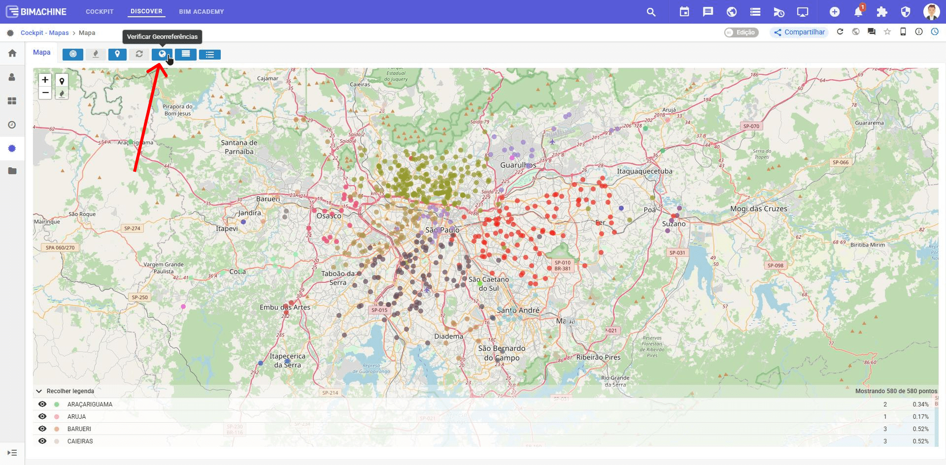
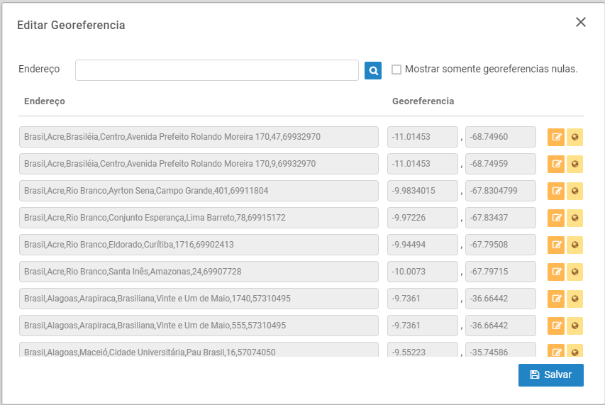
To check that the geolocation has been generated correctly and view the resulting coordinates, click on the button highlighted in the image below directly by the object. If the configuration is correct, values such as: -29.4644694,-51.9673071

If you get something like “0,0” or “null,null” it’s a sign that there’s been an error in the loads, so check how you’ve set up the location for the georeference by accessing the structure’s settings. Find out more about georeferencing adjustments in structures by clicking here.

With this information well configured, your maps in BIMachine will be accurate and reliable for geographical analysis.
If you find that there are no errors in the previous steps and any errors persist, please contact BIMachine and our support team will be happy to help you.

